Geography
- Introduction
- Curriculum
- Teaching & Learning
- Learning Resources
- E-Learning initiatives
- Seminar, Conferences, Webinar and Workshops
- Notices & Events
- Contact Information
History of the Department
The Department of Geography is one of the oldest Departments of Dr.Meghnad Saha College, which was started functioning General Course from August 2000. But in the year 2003, the Honours course was introduced which completion the demand of the local as well as outsider students. The Department have two laboratories i.e. RS & GIS (Computer Lab) and geographical laboratory (Cartographic Lab) with available survey and mapping instruments. It has a comprehensive curriculum on topics related to software with an emphasis on practical learning which is affiliated to the University of Gour Banga. The Department also has a legacy of holding invited special lectures, conducting workshops and other academic-related activities regularly. Presently, the Department is offering minor soil test laboratory. The department have two smart classrooms where regular basis audio-visual classes are taken by the departmental faculties. Every year the practical experience of subject through Field visit as well as excursion is done by the department. The Department is making significant contributions to the pedagogic improvement in the educational scenario of the district as well as the region.
Vision and Mission
- To impart Geographical thinking to the students.
- To create interest to opt for Geography as a major subject in higher education.
- To increase of standard of our students to local as well as global levels and make them employable and self-dependent.
- To improve the practical base knowledge about different perspective.
- To provide a platform to the students to exhibits their talents and creativity.
- To provide Geographical background for higher level.
- To encourage self-evaluation, personality development and guide the students to strive towards perfection and competence.
- Department of Geography provides outstanding teaching and learning environment with its focus on continuing educational process.
- Department provides experimental field base teaching and learning opportunity.
Honours Program
Objectives of Honours Program
- Develop of the ability to solve any problem
- Able to handle Remote Sensing, GIS and modern map making techniques
- Development of observation power of any geographical phenomena.
- Understand environmental ethics and sustainability
- The graduates will become successful professionals by demonstrating logical and analytical thinking abilities.
- The graduates will work and communicate effectively in inter-disciplinary environment, either independently or in a team, and demonstrate leadership qualities.
Syllabus for the Honours Program
*For(1+1+1) system students – CLICK HERE
*For CBCS system students- CLICK HERE
Course Outcome for 1+1+1 students
Part – I
Module 1:Geotectonic
- Understand the effect of origin of earth, earth’s rotation and movements.
- Acquire knowledge of internal structure of the earth.
- Understand the evidence and mechanism of internal earth.
- Understand the forces acting on lithospheric action and its resultant topography.
- To know about surface expression.
Module 2: Oceanography
- Understand about the ocean floor, ocean currents and its causes, significance and Knowledge about effect of ocean Current.
- Study about types of marine deposits.
- Understand resource potential of Ocean.
Module 3: Geomorphology
- Understand the nature, scope and significance of geomorphology and fundamental concepts in subject.
- To examining the Origin and Evolution of the earth primary relief features by different theories in subject.
- Realize about Exogenous Processes considering weathering and mass wasting process.
- Acquire acquaintance about origin, processes and their topographic landforms. Like; wind, glacial, waves, underground water and river etc.
- Understand the Evaluate the fundamental Model of Davisian Cycle of Erosion, Penck’s and Hack’s equilibrium theory to learn the function of river and its landforms development process.
- To recognize and understand the drainage development and their landforms of uniclinal folded and faulted structure with special reference of India.
Module 4: Hydrology
- To understand the modes of occurrence of water in the earth.
- Knowledge about evaporation, transpiration and infiltration process.
- Acquire knowledge of ground water storage and movement with related problems.
- Acquire knowledge about rain water harvesting.
Module 5: Practical – 1
-
-
- To learn drawing of Scale Diagram for representing geographical data.
- Skill of drawing of map, grapes, diagrams scale.
- Get skill of drawing choropleth, dot and sphere, pie-chart and proportional divided circle.
- Understand the mechanism function of topographical maps.
-
Part – II
Module 6: Economic Geography
-
-
- Understand about the Scope and definition of Economic Geography with environmental aspects and conservation.
- Understand and apply the natural resource. Like; land, forest and environmental significance, power resources like; coal, petroleum and hydel power distribution and conservation processes.
- Compare the different activities of different power resources and its applicability.
- Understand the fundamental theories in subject.
- To understand the different types of transport and communication importance.
-
Module 8: Climatology
-
-
- Understand the structure, composition of Atmosphere and insolation, heat budget with vertical and horizontal temperature.
- Understand weather phenomena winds, humidity, precipitation (mechanism of precipitation with fundamental theories), and general circulation of the atmosphere.
- Understand the concept of temperature and factors, horizontal, vertical and inversion of temperature.
- Study of Indian monsoon and El Nino and La Nina and world koppen’s classification.
-
Module 9: Soil Geography and Bio-Geography
-
-
- To study the soil forming process.
- To understand Chemical and physical properties of soil and its influence on fertility.
- Understand the ecology, ecotone and community.
- Concepts of about carbon and nitrogen cycle.
- Acquire knowledge about biodiversity and degradation and conservation of wetlands.
-
Module 10: Practical- 2
-
-
-
- To prepare the area measurement.
- Get skill of Drawing of projection.
- Aquaria knowledge of map making techniques.
- To understand to choose of projection according purpose of making maps.
- Understand and apply the different surveying like Prismatic Compass, Theodolite, Plane Table and contouring.
-
-
Part – III
Module 11: Population Geography
-
-
-
- Understand the history of population and basic sources of data
- Study of spatial distribution and density, concept of population and its trends, cause and consequences.
- Get knowledge of population theories Malthus, DTT and population resource region of Ackerman.
- Investigate Current Issues and Problems population growth in India.
-
-
Module 13: Geographical Thought
-
-
-
- Students understand the scope and evolution of geography as a discipline contribution of eminent geographers.
- To learn about the man-environment relationship.
- Understand the conceptualizing location, space and time.
- Compare between the fundamental concepts in geography these are systematic Geography versus Regional Geography, Physical Geography versus Human Geography.
- To understand the concepts of paradigm shift in geography like; quantitative revolution, radical geography, humanistic and behavioural geography.
-
-
Module 14: Social and Cultural Geography
-
-
-
- Understand the scope and content of social and cultural geography.
- Understand the concept of social process, social groups, social structure social well-being, social inequality and its present position.
- To understand the present status of social problems of Indian villages, gender inequality and women empowerment and about the tribes of India.
- Students understand about the concepts of culture, community, society, cultural groups, region, cultural realm, cultural hearth and cultural landscape.
-
-
Module 15: Political Geography
-
-
-
- Students Understand about the scope and content of political geography.
- Get knowledge about Evolution of states, nations, frontier, boundary and territory.
- Students understand the geostrategic ideas of Ratzel, Makinder and Spykman.
- Get knowledge of Geopolitical importance of India and Indian Ocean.
-
-
Module 16: Geography of India
-
-
-
- Students know to the major physiographic division and geomorphological characteristics of Indo-Gangetic plain.
- Understand about the Indian climatic zone, soil zones, vegetation zone and its depletion and conservation processes.
- Acquire knowledge about Indian agriculture and its modernization and its related problems.
- Understand the industrial region, changing concepts of location of industry with automobile and electronics industry.
- Get knowledge about the processes of globalization and liberalization and its impact of Indian economy.
-
-
Module 17: Practical- 3
-
-
-
- Able to identify rocks and minerals
- Understand the methods of tabulation
- Able to measure the central tendency of any data
-
-
Module 18: Practical- 4
-
-
-
-
- Get knowledge about statistics.
- Get knowledge about sampling.
- Able to measure the central tendency of any data.
- Able to learn how to collect data from field.
- Get some basic idea about geological sequence of rock beds.
-
-
-
Course Outcome for CBCS students
Semester-I
DC1A: Geotectonic and Geomorphology
(04) and DC1B: Practical (02)
- Understand the effect of origin of earth, earth’s rotation and movements.
- Acquire knowledge of internal structure of the earth.
- Understand the evidence and mechanism of internal earth.
- Understand the forces acting on lithospheric action and its resultant topography.
- To know about surface expression.
- Understand the nature, scope and significance of geomorphology and fundamental concepts in subject.
- To examining the Origin and Evolution of the earth primary relief features by different theories in subject.
- Realize about Exogenous Processes considering weathering and mass wasting process.
- Acquire acquaintance about origin, processes and their topographic landforms. Like; wind, glacial, waves, underground water and river etc.
- Understand the Evaluate the fundamental Model of Davisian Cycle of Erosion, Penck’s and Hack’s equilibrium theory to learn the function of river and its landforms development process.
To recognize and understand the drainage development and their landforms of uniclinal, folded and faulted structure with special reference of India.
DC2A: Cartographic Techniques(04) and DC2B: Practical (02)
- Get knowledge about the scale
- Able to understand about co-ordinate system
- Acquire knowledge about map projection
- Able to conduct field survey
- Understand the mechanism function of topographical maps.
Semester-II
DC3A: Population and Settlement
Geography (04) and DC3B: Practical (02)
- Understand the history of population and basic sources of data
- Study of spatial distribution and density, concept of population and its trends, cause and consequences.
- Get knowledge of population theories Malthus, DTT and population resource region of Ackerman.
- Investigate Current Issues and Problems population growth in India.
- Get knowledge of population policy of India.
- Understand the scope and content of settlement geography.
- Acquire knowledge about origin of rural and urban settlement and their history.
- To know the different theories of the subject.
DC4A: Cartograms and Thematic
Mapping (04) and DC4B: Practical (02)
-
-
- Get knowledge about logarithm and anti-logarithm.
- Get skill of drawing choropleth, dot and sphere, pie-chart and proportional divided circle
- Skill of drawing of map, grapes, diagrams scale.
- Able to handle GIS software
-
Semester-III
DC5A: Climatology (04) and DC5B: Practical (02)
-
-
- Understand the structure, composition of Atmosphere and insolation, heat budget with vertical and horizontal temperature.
- Understand weather phenomena winds, humidity, precipitation (mechanism of precipitation with fundamental theories), and general circulation of the atmosphere.
- Understand the concept of temperature and factors, horizontal, vertical and inversion of temperature.
- Study of Indian monsoon and El Nino and La Nina and world koppen’s classification.
-
DC6A: Statistical Methods in Geography (04) and DC6B: Practical (02)
-
-
- Get knowledge about statistics.
- Get knowledge about sampling
- Able to measure the central tendency of any data
-
Semester-IV
DC8A: Regional Planning and
Development (04) and DC8B:Practical (02)
-
-
- To understand the region, regional planning and its theories in subject.
- Compare the development and under development in Indian scenario.
- Understand the regional planning, rural-urban planning and different theories like; Growth pole and Myrdal for regional influence.
-
DC9A: Economic Geography (04) and DC9B:Practical (02)
-
-
- Understand about the Scope and definition of Economic Geography with environmental aspects and conservation.
- Understand and apply the natural resource. Like; land, forest and environmental significance, power resources like; coal, petroleum and hydel power distribution and conservation processes.
- Compare the different activities of different power resources and its applicability.
- Understand the fundamental theories in subject.
- To understand the different types of transport and communication importance.
-
DC10A: Environmental Geography(04) and DC10B:Practical (02)
-
-
- Able to understand the surrounding environment
- Get knowledge about ecosystem
- Able to understand and analysis about urban environment problem
-
Semester-V
DC11A: Soil & Bio Geography (04) and DC11B: Practical (02)
-
-
- To study the soil forming process.
- To understand Chemical and physical properties of soil and its influence on fertility.
- Understand the ecology, ecotone and community.
- Concepts of about carbon and nitrogen cycle.
- Acquire knowledge about biodiversity and degradation and conservation of wetlands.
-
DC12A: Hydrology and Oceanography (04) and DC12B: Practical (02)
-
-
- To understand the modes of occurrence of water in the earth.
- Knowledge about evaporation, transpiration and infiltration process.
- Acquire knowledge of ground water storage and movement with related problems.
- Acquire knowledge about rain water harvesting.
-
- Understand about the ocean floor, ocean currents and its causes, significance and Knowledge about effect of ocean Current.
- Study about types of marine deposits.
- Understand resource potential of Ocean.
-
Semester-VI
DC13A: Disaster
Management (04) and DC13B: Practical (02)
-
-
- Get knowledge about how and why flood occur
- Able to determine flood year
- Able to analyze hydrological drought
-
DC14A: Evolution of Geographical Thought (04) and DC14B: Practical (02)
-
-
-
- Students understand the scope and evolution of geography as a discipline contribution of eminent geographers.
- To learn about the man-environment relationship.
- Understand the conceptualizing location, space and time.
- Compare between the fundamental concepts in geography these are systematic Geography versus Regional Geography, Physical Geography versus Human Geography.
- To understand the concepts of paradigm shift in geography like; quantitative revolution, radical geography, humanistic and behavioral geography.
-
-
General Program
Objective of General Program
-
-
-
- Develop the ability to solve any problem
- Develop the ability to work with team and lead the team
- Understand environmental ethics and sustainability
- Evaluate derivatives for complexly constructed elementary functions;
-
- Interpret map using Remote Sensing and GIS platform
-
-
Syllabus for the General Program
*For 1+1+1 system students –CLICK HERE
* For CBCS system students- CLICK HERE
Course Outcome Outcome For 1+1+1 students
Part-I
Paper – I
-
-
-
- Understand the effect of origin of earth, earth’s rotation and movements.
- Understand the evidence and mechanism of internal earth.
- Understand the forces acting on lithospheric action and its resultant topography.
- Realize about Exogenous Processes considering weathering and mass wasting process.
- Acquire acquaintance about origin, processes and their topographic landforms. Like; wind, glacial, waves, underground water and river etc.
- Knowledge about evaporation, transpiration and infiltration process.
- Acquire knowledge of ground water storage and movement with related problems.
-
-
Paper – II
-
-
-
- Understand the structure, composition of Atmosphere and insolation, heat budget with vertical and horizontal temperature.
- Understand weather phenomena winds, humidity, precipitation (mechanism of precipitation with fundamental theories), and general circulation of the atmosphere.
- To study the soil forming process.
- To understand Chemical and physical properties of soil and its influence on fertility.
- Acquire knowledge about biodiversity and degradation and conservation of wetlands.
-
-
Paper – III
-
-
-
- To prepare the area measurement.
- Get skill of Drawing of projection.
- Aquaria knowledge of map making techniques.
- To understand to choose of projection according purpose of making maps.
-
-
Part – II
Paper – IV
-
-
-
- Understand the history of population and basic sources of data
- Study of spatial distribution and density, concept of population and its trends, cause and consequences.
- Understand the scope and content of settlement geography.
- Acquire knowledge about origin of rural and urban settlement and their history.
-
-
Paper – V
-
-
-
- Understand about the Scope and definition of Economic Geography with environmental aspects and conservation.
- Understand and apply the natural resource. Like; land, forest and environmental significance, power resources like; coal, petroleum and hydel power distribution and conservation processes.
- To understand the different types of transport and communication importance.
-
-
Paper – VI
-
-
-
- To prepare the area measurement.
- Understand and apply the different surveying like prismatic compass, Theodolite, plane table and contouring.
-
-
Part – III
Paper – VII
-
-
-
- Students able know to the major physiographic division and geomorphological characteristics of Indo-Gangetic plain.
- Understand about the Indian climatic zone, soil zones, vegetation zone and its depletion and conservation processes.
- Get knowledge of population policy of India.
-
-
Paper – VIII
-
-
-
- Get knowledge about statistics.
- Able to measure the central tendency of any data.
- Able to know about geological structure.
- Get knowledge about remote sensing and GIS.
-
-
Course Outcome for CBCS students
Semester-I
GE1A: Geotectonic and Geomorphology (04) and GE1B: Practical (02)
-
-
-
- Understand the nature, scope and significance of geomorphology and fundamental concepts in subject.
- To examining the Origin and Evolution of the earth primary relief features by different theories in subject.
- Realize about Exogenous Processes considering weathering and mass wasting process.
-
-
To recognize and understand the drainage development and their landforms of uniclinal folded and faulted structure with special reference of India.
GE2A: Cartographic Techniques(04) and GE2B: Practical (02)
-
-
-
- Able to understand about co-ordinate system
- Acquire knowledge about map projection
- Able to conduct field survey
- Understand the mechanism function of topographical maps.
-
-
Semester-II
GE3A: Population and Settlement Geography (04) and GE3B: Practical (02)
-
-
-
- Understand the history of population and basic sources of data
- Study of spatial distribution and density, concept of population and its trends, cause and consequences.
- Investigate Current Issues and Problems population growth in India.
- Get knowledge of population policy of India.
-
- Understand the scope and content of settlement geography.
- Acquire knowledge about origin of rural and urban settlement and their history.
- To know the different theories of the subject.
-
-
GE4A: Cartograms and Thematic Mapping (04) and GE4B: Practical (02)
-
-
-
- Get knowledge about logarithm and anti-logarithm.
- Get skill of drawing choropleth, dot and sphere, pie-chart and proportional divided circle
- Skill of drawing of map, grapes, diagrams scale.
-
-
Semester-III
GE5A: Climatology (04) andGE5B: Practical (02)
-
-
-
- Understand the structure, composition of Atmosphere and insolation, heat budget with vertical and horizontal temperature.
- Understand the concept of temperature and factors, horizontal, vertical and invarsion of temperature.
- Study of Indian monsoon and El Nino and La Nina and world koppen’s classification.
-
-
GE6A: Statistical Methods in Geography (04) and GE6B: Practical (02)
-
-
-
- Get knowledge about statistics.
- Get knowledge about sampling
- Able to measure the central tendency of any data
-
-
Semester-IV
GE8A: Regional Planning and Development (04) and GE8B:Practical (02)
-
-
-
- To understand the region, regional planning and its theories in subject.
- Compare the development and under development in Indian scenario.
- Understand the regional planning, rural-urban planning and different theories like; Growth pole and Myrdal for regional influence.
-
-
GE9A: Economic Geography (04) and GE9B:Practical (02)
-
-
-
- Understand about the Scope and definition of Economic Geography with environmental aspects and conservation.
- Understand and apply the natural resource. Like; land, forest and environmental significance, power resources like; coal, petroleum and hydel power distribution and conservation processes.
- Compare the different activities of different power resources and its applicability.
-
-
GE10A: Environmental Geography (04) and GE10B:Practical (02)
-
-
-
- Able to understand the surrounding environment
- Get knowledge about ecosystem
- Able to understand and analysis about urban environment problem
-
-
Semester-V
GE11A: Soil & Bio Geography (04) and GE11B:Practical (02)
-
-
-
- To study the soil forming process.
- To understand Chemical and physical properties of soil and its influence on fertility.
- Concepts of about carbon and nitrogen cycle.
- Acquire knowledge about biodiversity and degradation and conservation of wetlands.
-
-
GE12A: Hydrology and Oceanography (04) and GE12B:Practical (02)
-
-
-
- To understand the modes of occurrence of water in the earth.
- Knowledge about evaporation, transpiration and infiltration process.
- Acquire knowledge of ground water storage and movement with related problems.
- Understand about the ocean floor, ocean currents and its causes, significance and Knowledge about effect of ocean Current.
- Understand resource potential of Ocean.
-
-
Semester-VI
GE13A: Disaster Management(04) and GE13B: Practical (02 )
-
-
-
- Get knowledge about how and why flood occur
- Able to determine flood year
- Able to analyze hydrological drought
-
-
GE14A: Evolution of Geographical Thought(04) and GE14B: Practical (02 )
-
-
-
-
- Students understand the scope and evolution of geography as a discipline contribution of eminent geographers.
- Compare between the fundamental concepts in geography these are systematic Geography versus Regional Geography, Physical Geography versus Human Geography.
- To understand the concepts of paradigm shift in geography like; quantitative revolution, radical geography, humanistic and behavioural geography.
-
-
-
Faculty Profile
| DR MUKUNDA MISHRA | 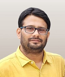 |
| ASSISTANT PROFESSOR (STAGE 2) & DESIGNATED AS VICE PRINCIPAL | |
| M.Sc. (Gold Medalist), Ph.D. | |

|
| Rupai Hembram | 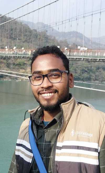 |
| ASSISTANT PROFESSOR & HOD | |
| M.A. in Geography | |

|
| DR. GOUTAM SARKAR. | 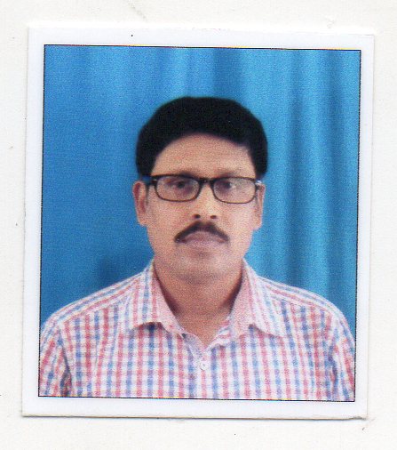 |
| SACT | |
| M.A., Ph.D. | |

|
| Dr. Arabinda Roy |  |
| SACT | |
| M.A.; B.Ed.; Ph.D. | |

|
| Jayanta Mondal | 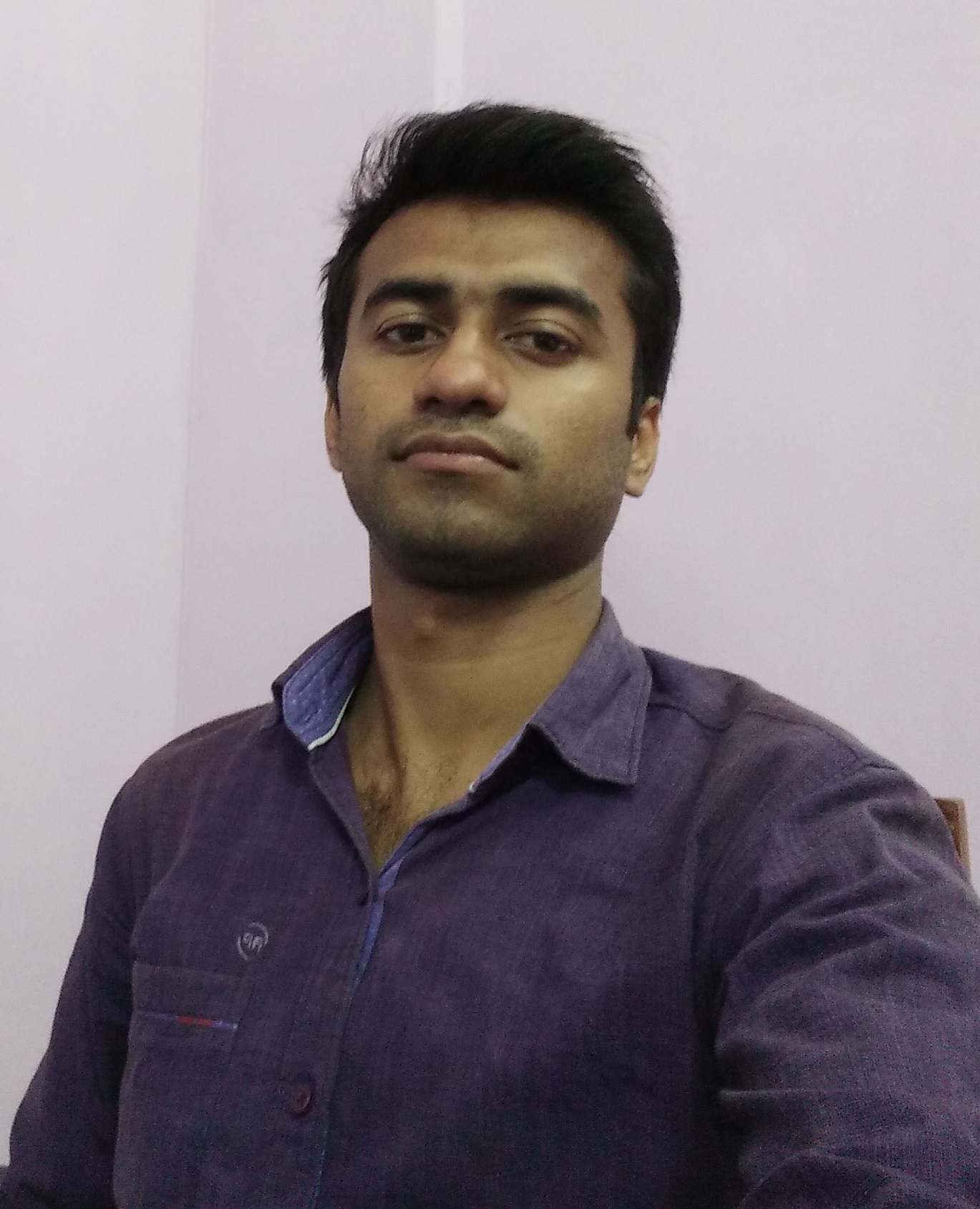 |
| SACT | |
| M.A., B.Ed. | |

|
| Mahabur Sarkar |  |
| SACT | |
| M.Sc., B.Ed., Ph.D. (Pursuing) | |

|
| Nojrul Islam | 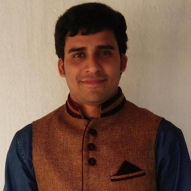 |
| SACT | |
| B.A.(Hons.),B.Ed,M.A,PDPET. | |

|
Students
Intake
| UR | OBC-A | OBC-B | SC | ST | PH | TOTAL | |
| 31 | 06 | 05 | 14 | 4 | 0 | 60 |
Enrollment
Enrollment 2019-20, 1st semester Honours
| Total | Male | Female | SC | ST | OBC-A | OBC-B | General |
| 52 | 33 | 19 | 13 | 3 | 9 | 9 | 18 |
Enrollment 2019-20, Part II Honours
| Total | Male | Female | SC | ST | OBC-A | OBC-B | General |
| 34 | 25 | 9 | 11 | 2 | 6 | 5 | 10 |
Enrollment 2019-20,Part III Honours
| Total | Male | Female | SC | ST | OBC-A | OBC-B | General |
| 24 | 16 | 8 | 8 | 2 | 2 | 4 | 8 |
Geography General Course
| Section-A | Section-B | Section-C | TOTAL |
| 58 | 0 | 0 | 58 |
Teaching Methods
-
-
-
-
- Internal assessment
- The Department of Geography regularly organizes Internal Assessment for the students. This kind of evaluation procedure helps to students to have a deeper knowledge about the subject. Besides this, the internal assessment procedure divides the syllabus in smaller parts and assesses the individual student’s development in the selected part of the syllabus. The continuous process of evaluation also prepares the student for the final examination.
-
-
-
-
-
-
-
- Group Discussion
- For the complete development of the students both in the curricular as well as co-curricular activities, the Department of Geography arranges regular group discussion among the students. The students of a particular batch are divided into number of groups. They are encouraged to present their individual opinions and to share it with their group mates. This kind of teaching methodology is a part of a participatory learning process. It also helps the slow learners in better understanding of the subject.
-
-
-
-
-
-
-
- Quiz
- Quiz is a very important teaching methodology to engage the student with the informative aspect of the subject. As a participant in the quiz, the student is also motivated to study the topic in more details. Keeping in mind the popularity of quiz, the Department of Geography organizes quiz for each batch of students to make learning more enjoyable as well as engaging for them.
-
- Participatory Learning
- The Department of Geography has developed multiple methods of participatory learning for the students. The department organizes regular group discussion among the students to encourage them to develop their individual opinion about the curricular as well as co-curricular topics. Besides this, the Department arranges for field visits for the students, so that the students can develop the habit of participatory learning by using the real database. Departmental excursion is also organized by the department at regular intervals where the students participate to make various kinds of analysis, report etc. to represent a particular topic from their syllabus. It would help them to understand the subject in a more interactive way.
-
-
-
-
-
-
-
- Strategies for slow learners
- Participatory learning is very useful for the slow learners. They are incorporated into the various study groups in which the advanced learners engage with them and help them to understand the topic. Besides the regular internal assessment, remedial classes are also arranged by the Department of Geography for the slow learners where they are encouraged to clear their doubts about the curriculum.
-
-
- Project work/ Lab based learning/ Dissertation etc:
- The students have lab course in their curriculum, for that the department organizes regular class in Computer lab. The students also given hands-on basic training to the basic functions of a computer
-
-
-
-
2019-2020
Workshop on Basics of Q-GIS
-
-
-
-
-
- Date: 31 January, 2020 to 3February, 2020
- Resource Persons:
- Tanmoy Sarkar
-
-
-
-
Assistant Professor Department of Geography GazoleMahavidyalaya Malda, West Bengal, India.
-
-
-
-
-
- Number of Participants: 50
-
-
-
-
Workshop Outcome:The workshop was jointly organized by the Department of Geography, Dr. MeghnadSaha College and Department of Geography, GazoleMahavidayalaya. The lecture was delivered by Tanmoy Sarkar, Assistant Professor, Department of Geography,GazoleMahavidayalaya. Participants were enabled to handle Q-GIS software.
Statics for Social Science
-
-
-
-
-
- Date:25th February to 2nd March 2020
- Key Note Speaker
-
-
-
-
Professor Malay Mukhopadhyay Professor of Geography Visba- Bharati, Birbhum West Bengal, India
-
-
-
-
-
- Resource Persons:
-
-
-
-
Professor Baidya Nath Pal Associate Scientist Indian Statistical Institution Kolkata, West Bengal, India
Professor Soumendu Chatterjee Department of Geography Kolkata, West Bengal, India
Professor SanatGucchait Department of Geography University of Burdwan Burdwan, West Bengal, India
-
-
-
-
-
- Number of Participants: 159
-
-
-
-
-
-
-
-
-
- Workshop Outcome: The workshop was organized by the Department of Geography, Dr. MeghnadSaha College. The lecture was delivered by eminent scientist Baidya Nath Pal and renowned geographer Professor Malaya Mukhopadhyay. Participants were enabled to use SPSS to handle socio-economic data.
-
-
-
-
2018-2019
An Extension Lecture on Mountain Environment Landscape and Disaster: Through The Eyes of Those Who Witnessed It
-
-
-
-
-
- Date: 21 January, 2019.
- Resource Person:
-
-
-
-
Sri Tushar Kanti Dey Tapadar and Sri Umang Mukhia Consultant and Permanent Instructor Himalayan Mountaineering Institute Darjeeling, West Bengal
-
-
-
-
-
- Number of Participants: 107.
- Outcome of the Special Lecture:
-
-
-
-
The special lecture was organized by the Department of Geography, Dr. MeghnadSaha College. The lecture was delivered by Sri Tushar Kanti Dey Tapadar and Sri Umang Mukhia. Participants got knowledge about the special geographic feature i.e. mountain.
Workshop on Q-GIS for Beginners
-
-
-
-
-
- Date: 9 March, 2019 to 15 March, 2019.
- Resource Person:
-
-
-
-
Tanmoy Sarkar Assistant Professor Department of Geography GazoleMahavidyalaya Malda, West Bengal, India.
-
-
-
-
-
- Number of Participants: 83.
- Outcome of the Workshop:
-
-
-
-
The workshop was jointly organized by the Department of Geography, Dr. MeghnadSaha College and Department of Geography, GazoleMahavidayalaya. The lecture was delivered by Tanmoy Sarkar, Assistant Professor, Department of Geography,GazoleMahavidayalaya. Participants were enabled to handle Q-GIS software.
2017-2018
Special Lecture on ‘Fluvial System Dynamics: An Interaction Between Components and Variables’
-
-
-
-
-
- Date: 12March, 2018.
- Resource Person:
-
-
-
-
Prof. Sujit Mandal Professor and HoD Department of Geography Diamond Harbour Women University Sarisha, Diamond Harbour West Bengal
-
-
-
-
-
-
- Number of Participants: 69.
- Exhibition Outcome: The special lecture was organized by the Department of Geography, Dr. MeghnadSaha College. The lecture was delivered renowned professor of Geography professor Sujit Mandal. The participants abled to learn basic concept about fluvial system.
-
-
-
-
-
Geo Award list Date-2020.01.15
Geo Notice Date-2020.01.06 (2)
Geo Award list Date-2019.12.18
Geo Award list Date-2019.11.22.
Geo Award list Date-2019.11.22
Geo Award list Date-2019.11.20
Geo Award list date-2019.11.18
Geo Notice Date-2019.11.16 (2)
-
-
-
-
-
-
-
- Telephone No.: +91-94750-94594
- Email: drmsc.geodept@gmail.com
- WhatsApp Group Link
-
- Semester-1: CLICK HERE
- Semester-2: CLICK HERE
- Part-2: CLICK HERE
-
- Facebook Page: CLICK HERE
-
-
-
-
-
-


